I-80 Accidents Today — Live Corridor Watch
Quick answer: 0 news reports naming the I-80 in the last 24 hours, 0 in the last 7 days; 9 official live incidents on or near the road right now; 0 geocoded reports within 20 km. The I-80 is the 2,900-mile transcontinental interstate over Donner Pass and the Great Salt Lake desert through Cheyenne, Omaha, Des Moines, Chicago and Cleveland to the George Washington Bridge.
Latest reports naming the I-80
News items from the last 7 days whose headline names the road, country-matched. Every item links to the publisher.
No headline has named the I-80 in the last 7 days. Live country-wide reports are on the United States page.
Live incidents on or near the I-80 right now
Transport-authority and traffic-data incidents within 20 km of the centreline, nearest first.
| Source | Area | Details | km from road | |
|---|---|---|---|---|
| CHP / Caltrans QuickMap | California | 20002-Hit and Run No Injuries — 4500 Orange Grove Ave | 0.5 | |
| CHP / Caltrans QuickMap | California | 20002-Hit and Run No Injuries — I80 E / Buchanan St Ofr | 1.1 | |
| MapQuest | New York | — | 2.2 | |
| PennDOT | Pennsylvania | Downed tree: (3020) PENNSYLVANIA CREEK RD near FOUNDRY ST | 4.8 | |
| CHP / Caltrans QuickMap | California | Trfc Collision-No Inj — 800 Del Valle Cir | 5.7 | |
| MapQuest | New York | — | 6.3 | |
| CHP / Caltrans QuickMap | California | Trfc Collision-Unkn Inj — I80 W / Maritime Academy Dr Ofr | 10.9 | |
| PennDOT | Pennsylvania | Downed tree: (1020) LAKE MINSI DR / E. MAIN ST / WEST BANGOR RD / SECOND ST near GARIBALDI AV | 11.5 | |
| CHP / Caltrans QuickMap | California | Trfc Collision-Minor Inj — 7575 Power Inn Rd | 12.5 |
Authority alerts along the I-80 (last 12 hours)
Live posts by transport authorities, read through the public Bluesky API and quoted with a link to the original. Incident posts are listed first.
Source: 511 SF Bay (Metropolitan Transportation Commission) — public posts, © their agencies; re-read every 15 minutes.
Live traffic cameras along the I-80
Public traffic-camera snapshots nearest to the latest geocoded reports on this page, straight from the transport authority. Images refresh on their own schedule (seconds to minutes); a camera is picked by distance and is not necessarily pointed at the incident.
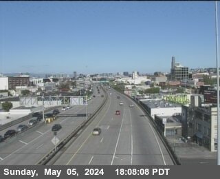
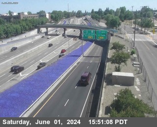
Camera data: Caltrans (California Department of Transportation) (all 2,836 cameras) · NVRoads / Nevada Department of Transportation (all 652 cameras) · UDOT Traffic (Utah Department of Transportation) (all 2,082 cameras) · 511PA / Pennsylvania Department of Transportation (all 1,563 cameras) · 511LA / Louisiana DOTD (all 336 cameras). Snapshots are served by the authority and are not stored by this site. Cameras marked Live video play inline; the rest are still images refreshed by the authority.
I-80 accident history
Recorded fatal crashes (NHTSA FARS 2020–2024) on this road by year, severity, road user, place and time of day.
I-80 — FAQ
Is there an accident on the I-80 today?
Where does this I-80 page get its data?
How is 'near the I-80' defined?
What should I do if I am in a crash on the I-80?
Corridor pages are computed from feeds already on this site (official incidents, news, cameras) — nothing here is estimated. Country context: United States accidents today.