LIVE Global accident monitoring — updating every 15 minutes
Official feed · ODOT TripCheck · every 15 min

Oregon Traffic Incidents Right Now

Quick answer: 21 traffic incidents are live on Oregon roads and highways right now, on roads including US-20, US-97, OR-229, as published by ODOT TripCheck and read 6 min ago. In an emergency call 911; for road conditions dial 511.

21
Live incidents
read 6 min ago
21
With a description
in the authority's words
15
Roads named
in current incidents
1
Official source
re-read every 15 min
— zones in view
Official traffic incident Accident report · last 24h Toggle CAMERAS for live views
21 live now

Current incidents on Oregon roads and highways

Each line is the incident exactly as ODOT TripCheck publishes it. Incidents leave this list when the authority clears them.

ODOT TripCheck Landslide: OR-229, ORE229, 10 miles North of Siletz × 2 44.809, -123.966
ODOT TripCheck Sunken Grade: US-101, US101, 7 miles North of Newport 44.727, -124.058
ODOT TripCheck Sunken Grade: US-26, US26, 4 miles East of Necanicum 45.910, -123.695
ODOT TripCheck Erosion: US-395, US395, 16 miles North of Long Creek 44.892, -119.013
ODOT TripCheck Road Surface Collapse: OR-201, ORE201, Ontario 44.022, -117.005
ODOT TripCheck Hazmat Cleanup: OR-207, ORE207, 8 miles South of Hardman 45.078, -119.654
ODOT TripCheck Fire: OR-35, ORE35, 13 miles East of Intersection with Warm Springs Highway US26 45.374, -121.567
ODOT TripCheck Agency Assist: US-20, US20, Intersection with The Dalles - California Highway US97 × 4 44.074, -121.302
ODOT TripCheck Crash: OR-7, ORE7, 15 miles North of Whitney 44.692, -118.065
ODOT TripCheck Agency Assist: US-97, US97, Madras 44.647, -121.123
ODOT TripCheck Fire: OR-224, ORE224, Ripplebrook Ranger Station 45.080, -122.043
ODOT TripCheck Pothole: OR-99, US199, Grants Pass 42.459, -123.323
ODOT TripCheck Crash: I-84, I-84, 19 miles West of La Grande 45.478, -118.400
ODOT TripCheck Crash: OR-204, ORE204, 15 miles East of Intersection with Oregon - Washington Highway ORE11 45.783, -118.182
ODOT TripCheck Crash: I-84, I-84, 9 miles East of La Grande 45.224, -118.014
ODOT TripCheck Crash: US-20, US20, 4 miles West of Brothers 43.833, -120.672
ODOT TripCheck Crash: US-20, US20, 2 miles South of Sisters 44.274, -121.514
Roads named in current incidents

Which Oregon roads have incidents now

Roads mentioned in live Oregon traffic incidents
RoadLive incidents
US-206
US-975
OR-2292
US-262
I-842
US-1011
US-3951
OR-2011
OR-2071
OR-351
OR-71
OR-2241
OR-991
US-1991
OR-2041
Official DOT feeds · live snapshots

Live traffic cameras in Oregon

Public traffic-camera snapshots nearest to the latest geocoded reports on this page, straight from the transport authority. Images refresh on their own schedule (seconds to minutes); a camera is picked by distance and is not necessarily pointed at the incident.
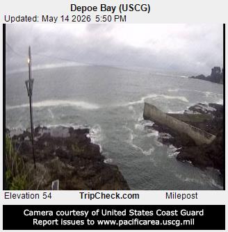
Traffic camera: Depoe Bay (USCG)
Depoe Bay (USCG)Oregon TripCheck (ODOT) · 7.6 km from: Landslide: OR-229, ORE229, 10 miles North of Siletz
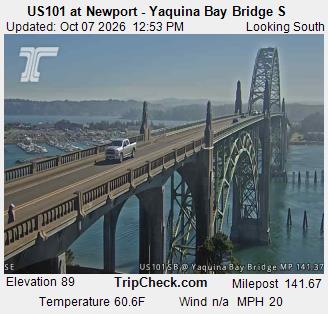
Traffic camera: US101 at Newport - Yaquina Bay Bridge S
US101 at Newport - Yaquina Bay Bridge SOregon TripCheck (ODOT) · 11.4 km from: Sunken Grade: US-101, US101, 7 miles North of Newport
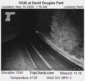
Traffic camera: US26 at David Douglas Park
US26 at David Douglas ParkOregon TripCheck (ODOT) · 1.8 km from: Sunken Grade: US-26, US26, 4 miles East of Necanicum
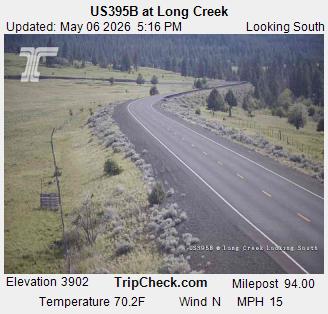
Traffic camera: US395B at Long Creek
US395B at Long CreekOregon TripCheck (ODOT) · 22.0 km from: Erosion: US-395, US395, 16 miles North of Long Creek
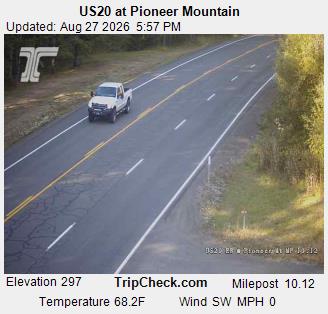
Traffic camera: US20 at Pioneer Mountain
US20 at Pioneer MountainOregon TripCheck (ODOT) · 15.0 km from: Landslide: OR-229, ORE229, 10 miles North of Siletz
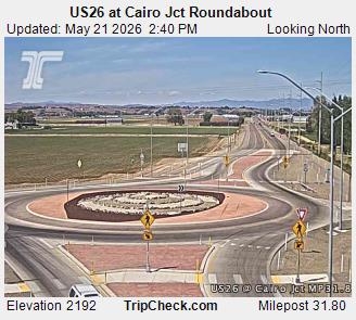
Traffic camera: US26 at Cairo Jct Roundabout
US26 at Cairo Jct RoundaboutOregon TripCheck (ODOT) · 3.7 km from: Road Surface Collapse: OR-201, ORE201, Ontario

Camera data: TripCheck / Oregon Department of Transportation (all 1,143 cameras). Snapshots are served by the authority and are not stored by this site. Cameras marked Live video play inline; the rest are still images refreshed by the authority.

Attribution

Where this Oregon data comes from

FeedPublished byRe-readLast readLive now
ODOT TripCheck ODOT TripCheck 15 min 6 min ago 21
More for Oregon

Related pages

Questions

Oregon traffic — FAQ

Are there any accidents or road closures in Oregon right now?
Yes. The official feed lists 21 active incidents on Oregon roads and highways as of 06:15 UTC on 12 October 2026, including reports on US-20, US-97, OR-229. The list on this page shows each one in the authority's own words.
Where does this Oregon traffic information come from?
Directly from ODOT TripCheck. The site reads the published feed every 15 minutes and keeps only incidents: crashes, closures, disabled vehicles, debris, flooding and similar hazards. Planned roadworks and maintenance are filtered out.
What should I do if I see a crash in Oregon?
If anyone is hurt or the road is blocked, call 911. Move to a safe place away from traffic before calling, give the road name, direction and nearest junction or exit, and do not stop in live lanes to take photos. For non-emergency road conditions, dial 511 or use the authority's 511 website.
Why are some incidents missing from the map?
Only incidents the authority publishes with coordinates can be mapped. Some reports carry only a road name, and incidents on local streets are often handled by police without appearing in the highway feed. News reports of accidents appear separately on the Oregon accidents today page.

Incident text is quoted from the publishing authority and remains its copyright. Coordinates are as published. Feed health for every source: status · methodology.